Sunday, September 26, 2010

A trip to Port Renfew

Saturday September 25th......
Today we decided that since we hadn't had enough of travelling and ferries that we would do a day trip to Port Renfew on the West side of Vancouver Island. There is an old logging road that leads from Honeymoon Bay on Lake Cowichan and winds over the mountains to the tiny town of Port Renfew which is a fishing spot and also being the end of the line from Victoria has a collection of old salties and drifters that couldn't make the trip back to the city and stayed.

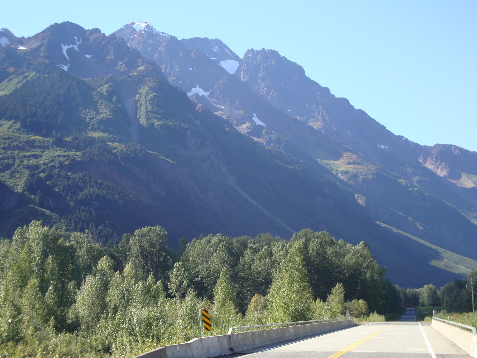
The trip there is through partially logged country with a stop here and there to see a remnant of what was a very beautiful coastal rainforest.

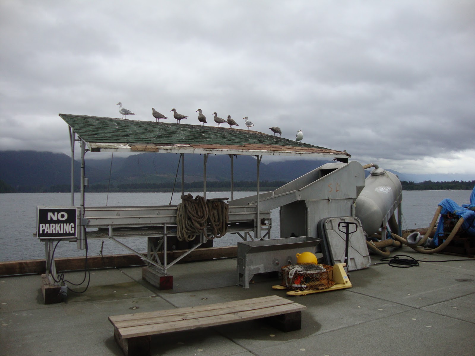
We stopped at The Harris Creek big Spruce which is situated on the banks of a fast flowing stream in a very wet and mossy rainforest filled with ferns and wild berries. Then past Lizard Lake and to Port Renfew. We have never seen this town in sunlight since we generally only visit in Winter when the big Pacific storms blast the West Coast. We've come through mists, torrential rains and blinding blizzards to get here in the past and today was mild in comparison with those trips.


For the first time ever we've come when the only hotel in town was open but even though the decor was very classy and West coast like with deep green walls and cool pictures and a nice water view the vegetarian fare was almost nonexistent so we decided to go back up the road to the Coastal Kitchen Cafe which was more cool and funky and had a very accomodating staff with a flexible menu.  Greg made the observation that when you go to a small town always check out to see where the locals go and that's most likely the spot to be ......so we had found the spot in town. We had a nice pizza and Mum had fish and chips. A few groups of off road bikers came in too. The staff had just come back that morning from a staff trip to Saltspring so we had to tell them we lived there too. They were raving about SSI but did note that it was very expensive there......we just smiled sagely feeling lucky to live where we do.

We took a walk out on the boardwalk and saw the seagulls riding back and forth on the waves as they washed up and down the rocky shore. There are some cabins that are built right on the rocky cliff face so maybe we take a weekend getaway in the Winter and walk in the lashing rains and roaring winds.

We then drove over the wet and misty road back to Lake Cowichan with Mum freaking out that we were all going to die if the road were to give way into the gorge below. Frankly I was thinking that if she carried on distracting me I would certainly fulfil that prophecy and drive willingly into oblivion.

We stopped at the Brass Bell in Crofton while we waited  for the ferry and the owner told us that a massive storm with winds of plus 100km an hour and lots of rain had hit the North Vancouver Island and cut off Port Hardy from power and road. My feelings after having been to Port Hardy that they could do with a lot more rain to clean that place up a bit. I also thought how lucky we were since today was supposed to be the day we came back on the ferry from Prince Rupert  and I don't think it would have been running given the storm and being trapped in a storm ravaged disaster zone isn't quite what I needed right now.

It's Mum's last week here so we have to get ourselves together and get music copied, photos printed, final shopping done and a short trip to Vancouver in to visit with friends as well.

Here comes the Autumn and the wet and fog ........a time that I like since it's time to settle down and introvert, wrap up and walk in the rain.

Wednesday, September 22, 2010

Day 15.......Port Hardy back to Saltspring Island

Today we decided to dash down Vancouver Island and get home to Saltspring as fast as possible. We got on the road at about 10am and made it to the Crofton terminal in time to catch the 2.30pm ferry to Vesuvius.
So here we are at home after a great trip that really does validate the license plate for British Columbia. We not only live in the Best place on Earth but also the most beautiful........and I don't think I'm being even slightly biased here.

All in all we travelled 2739kms by road and 832kms by ferry which makes a grand total of 3571kms in all.

Day 14.........Prince Rupert to Port Hardy

Today we started at 4am to get to the Northern Expedition ferry that leaves from Prince Rupert at 7.30am to get to Port Hardy. This trip is a 15 hour journey that goes down the Inside Passage via the Grenville Channel, past Bella Bella, Namu and then across the Queen Charlotte Strait to end at Port Hardy on the Northern tip of Vancouver Island.
We were very lucky that the weather was sunny although the sea breeze was pretty cold. We booked a very comfortable cabin with two beds and a toilet with shower. This ship is the replacement for the Queen of the North which sank two years ago after hitting an island near Hartley Bay in the middle of the night. Apparently this happened due to the fact that the two crew who were supposed to be steering the ship were actually bonking on the bridge instead........this is obviously not the way to behave during work hours. The Northern Expedition was built in Germany and really is a very clean, neat and comfortable ship to travel in. It has two restaurants, one that serves typical BC Ferries burgers and chips and the other that serves fancy meals and wines etc .........at fancy prices too. I might add to that at $680 for two people and a car this trip is hardly affordable for the average person as a method of transport through BC. Add to this the fact that due to the sailing times you are forced to have a hotel room at either end of the trip this boosts to the price to almost a thousand dollars a time. On both the Bella Coola trip and this one the majority of the passengers were German tourists so this tells a story in itself.
   Mountains of 1500 to 3500 feet surround Grenville Channel the beginning of the voyage, the narrowest portion a mere 1400 feet wide. Although the channel is so narrow it has depths of up to 1620 feet that allows large vessels to navigate it. This route is popular with the large Alaskan cruise liners that sail here during the Summer months.
  Hartley Bay is about 5 hours from Prince Rupert and here we saw a large number of Humpback Whales breeching and blowing.
  The scenery through all of this trip is quite breathtaking and we passed a number of red and white lighthouses. When we got to Bella Bella, a small town about 10 hours into the trip the ship slowed right down so as not to create a large wake that would damage the numerous docks in the area.
   We snoozed a bit and went for dinner at the fancy restaurant where once again I wasn't happy with the vegetarian options......this is a thing that BC Ferries has to look at in all of it's catering throughout it's operations. During dinner the sun was setting on the one side of the ship and the moon was rising on the other.....very lovely moment.
  When we got into Port hardy we unfortunately had to once again brave the dubious quarters of the Port Hardy Inn since all the other hotels had been booked by the busloads of German tourists.
    

Day 13........A lazy Sunday in Prince Rupert


We had Sunday to tool around Prince Rupert and get ourselves together for the trip back home so we had a late start and went back to Cow Bay and had a brunch of eggspesso.........a sort of scrambled egg dish of green peppers and green onions and egg heated through with the espresso machine steam. We wandered around and bought some gifts and then headed off to Port Edward. This is a small harbour where there is a fish cannery and not much else. The drive there was very pretty with small tree covered islands in lagoons surrounded by lush mountain slopes. Went back to the hotel (The Inn on the Harbour) and snoozed the afternoon away till dinner when we went to the La Gondola Italian Restaurant next to the hotel and watched the sun go down. Then to bed since the next day we are up at 4am to catch the Northern Expedition ferry to Port Hardy at 7.30am.

Sunday, September 19, 2010

Day 12.......Stewart to Prince Rupert via the Nass Lava fields and Gitlakdamix

It's time to start our way back South again so we climbed out of the bear River Valley leaving Stewart and headed for the restricted road to New Aiyansh. New Aiyansh or Gitlakdamix as it is known by the Nisga'a people is a very tidy town which has become the government center for this tribe. In 2000, after more than a century of negotiations, the Nisga'a signed the first modern-day treaty—the Nisga'a Final Agreement—negotiated with the federal government. Since then, the Nisga'a Lisims government based in New Aiyansh, about 150 kilometres north of Terrace, has overseen four traditional villages whose 2,500 inhabitants occupy the heart of the Nass Valley.
The drive from the Stewart Cassiar highway is very rough with potholes everywhere.
Just beyond Gitlakdamix is the star of the Nass lava beds. About 250 years ago a volcaniv eruption spewed lava into the nass valley that covered an area of about 10kms by 3 kms killing about 2000 of the Nisga'a.
The tribe has a legend about this time:

"The Nisga'a people, like most First Nation cultures, respect the land. From the land came food, tools and supplies. The respect for nature by the Nisga is often a theme in many of their stories told by the elders to the younger generation.
Over 250 years ago thou, the youth of the Nisga'a people did not take nature seriously, nor the warnings put forth by the elders. The youth, at that time, often went out and killed small wild animals leaving their bones to rot. Again, the elders warned them that the "Chief in the Sky" would not look kindly on the youth.
But then, during a strong salmon season when the salmon were migrating up river a child from the Wolf Clan started catching the fish and cutting slits in their backs. This was not done for food but only to insert burning pitch pine so when they put them back into the river they looked like swimming candles. The elders caught word and, again, warnings were given on deaf ears.
One day, during the preparations for the winter ceremonies, a large drum began beating in the distance. This worried the elders. The youth making light of the incident were caught saying, "a ha, the ghosts wake up, they are going to have a feast too." The elders knew the cruelty to the fish brought this on their village.
The drums eventually died down... only to begin again a week later but many times louder. Now together, the elders and youth became worried. Soon later a thunder-like noise erupted, and the mountains burst open and fire roared down the river killing many of the Nisga'a people.
To this day, the Shamans said the spirit world was angered by the torture of the salmon."

Although we were planning on staying over at Gitlakdamix we decided to hoof it on down to Prince Rupert via Terrace and along the Skeena River since there is a ferry leaving Monday and we are ready to spend some Saltspring time again.

Prince Rupert is in a quite beautiful setting. Nestled in amongst wooded islands with tons of lakes and small bays and inlets it has transformed from fishing town to a gateway harbour for grain and coal exports from the interior.

We had supper at Cow Bay which is a very funky part of the harbourfront that has taken the old buildings and renovated them into restaurants and shops. Tomorrow is Sunday and I think we'll take things easy and explore Prince Rupert and maybe take a trip up to Port Edward and the Butze Rapids. Then Monday we catch the ferry to Port Hardy via the Inside Passage........leave at 7.30am and arrive 10.30pm.

Friday, September 17, 2010

Day 11........The Berendon Glacier and many others too

Today we returned to the Salmon Glacier Summit but this time went further into the icefields. The road continues to the Berendon Glacier below which was the Portal Camp for the old Grand Duc copper mine. This mine was started in 1964 and a large camp to house the miners was set up at the base of the Berendon Glacier.This area gets some of the heaviest snowfalls on earth, averaging about 800 inches each year, with the record at over 1,100 inches. To the men working at the camp, the 16 feet of snow that fell in the second week of February 1965 merely meant some extra work to keep their work areas usable. But high above the camp, incredible pressures were building as the snow deepened. The snow piles up deeply in the coastal mountains - it's heavy snow, perfect for building glaciers, awful to work in. On the steep mountainsides above Portal Camp of the Granduc Mine, millions of tons of snow let loose at 10:16 AM, February 18, 1965. Virtually the entire camp was wiped out by the avalanche. Some of the survivors were missed when the slide split into two forks, and many were able to dig themselves out when they were buried. A massive rescue operation was mounted but 26 men lost their lives.
   Portal Camp was never reopened. No technology available could protect men working in that location against another avalanche. The options for extracting the ore were few - an open-pit mine would be impossible due to the snowfall, so engineers had to find a way to cut the tunnel using only the camp at Tide Lake, 10.3 miles from the main ore body. The huge extra expense involved nearly forced the mine into receivership, but on the basis of reserves of 32,500,000 tons of 1.93% copper ore, refinancing was arranged. After many tears of ups and downs, the mine closed in the 1980's and the camps were dismantled and the towns of Hyder and Stewart shrank dramatically.
    All that I could find was the concrete mine heads and scraps of metal plate and roofing today. Mum did a 2 minute slience for the dead while I took pictures of the place. This area is high in the mountains and I was just trying to visualise how it must look in the Winter with at least 400 inches of snow. Something I couldn't do.

We continued on till we reached a wide valley with a river flowing from the base of the Berendon Glacier and saw a small encampment of miners working at some other prospecting job. Mum had to feel the fresh glacial water and I counted 6 glaciers surrounding us........a truely marvelous sight. We were at the end of the road so we turned back and had lunch at the Salmon Glacier Summit spot then wound our way down the treacherous road back to Hyder and Stewart. In Hyder we stopped of at a Grocer Store and the owner was telling us how the snow starts in October and by January tops 15 feet and he can walk off his second floor balcony into the snow without a drop. All the folk round here have told me that they love the excitement of Winter but that they are all very prepared with generators and the like since they can be without power or roads for up to ten days at a time. This made me look at everything round here in a different way wondering which house would be the best one to have in the Winter.

So tomorrow we are off  down South to the Nass Lava beds and New Aiyansh and believe it or not but the weather is set to be super sunny again with temperatures in the low 20's.....we are so lucky.

Day 10 .........Hyder Alaska and the Salmon Glacier

Hyder is about 3km from Stewart and has a population of about 100 people. It grew, as with Stewart, to service the gold and silver mines in the Salmon river valley and the copper mine at the base of the Le Duc icefields about 50 kms away. About 10kms up the valley there is a bear viewing platform where for a $5 fee you can come and go and wait to see bears gorging on the salmon in the river below. We arrived just too late to see a sow and her baby and decided to see the glacier and try to find the bears later in the afternoon. The drive to the Salmon Glacier is quite stunning. You start at the valley floor driving on the south bank with lovely views of the Tongas forest mountains on the north bank. About 17kms up the valley the road starts to climb steeply and passes the old Premier Mine. The road hugs the mountainside for the next 20kms with switch backs and heartpounding, sheer drops being the order of the day. This road is not for the faint of heart.
Eventually we made it to the Summit viewpoint and the view is truely spectacular, made even more so since we came during one of the only clear days that this area sees. This place has one of the largest snowfalls in the World. It's not uncommon for 12 feet to fall overnight. The glacier is the 5th largest in the world and the elevation is 4300ft.
We drove further on but decided to turn back as it was getting late and we wanted to see the bears too. Since we are staying an extra day I will come up again tomorrow and get to the Grand Duc Mine shaft since the scenery is supposed to be quite incredible.
Back down the mountain and alas no bears again, then through Canada customs.....they let Mum through.....and an early night to be ready for the day ahead.  

Thursday, September 16, 2010

Day 9.......Smithers to Stewart

This is the last longish day drive for a while. 4 to 5 hours but through quite magical scenery. As we left Smithers on the left hand side is a large group of mountains with numerous hanging glaciers. What a lovely backdrop for a town. The farms in the head of the Bulkley Valley are very neatly looked after and the fields lush. This group of mountains extending up to New Hazelton are the Northern part of the Hazelton range before the start of the Stikine Range.

We drove through some spectacular valleys and steep sided cliffs and came to Moricetown where there were people down in the churning river gully scooping up salmon with nets. Coming into town there was a roadside billboard warning about a killer on the loose. The road between Prince George and Prince Rupert has been dubbed the Highway of Tears since between 1974 and 2002 probably 8 young girls have been murdered and their bodies either dumped off or never found on the side of this highway.

We got to Kitwanga, the turnoff to Stewart and got some pics under the sign North to Alaska. This road is very nice as it goes through totally uninhabited country with huge forests and boggy marshes and the Nass River here and there. We saw a bear wandering off into the thickets which reminded us to be more vigilant on our frequent photo stops.Through Kitwancool, cranberry Junction and towards a large snow capped group of mountains (Mnt Pattullo). This part almost felt as if we were trying to find the lost valley of Shangri-La. At Meziadin Junction we turned left on the Stewart and Hyder road. As we wound our way down this deep valley all around us were lakes, rivers and glaciers. It was like being in a Geography class again. About 15 minutes in we came across the Bear Glacier on the left and this is quite spectacular.
The road meanders through deep, dark ravines interspersed with beaver-dammed rivers until Stewart which is built on the estuary at the head of thePortland Canal.
Stewart has a population about 500 today but prior to WW1 was about 10000 mainly due to gold and silver mining. Precipitation is about 1800mm a year, most of it in snow and about 200mm falling in September alone. So we are lucky to have our whole visit in clear skies with 20C temperatures.
We are staying at the Kate Ryan which is part of the Ripley Creek Inn comprising about 4 renovated downtown buildings right on the estuary. The setup is what one would call very funky.
Tomorrow we will be off to the Salmon Glacier and the bear viewing spot near Hyder Alaska. Mumdoesn't have a visa for the USA so lets hope there is no problem since to get to Salmon Glacier the only road goes into the US at Hyder and then back into Canada.